For planning only – not suitable for navigational purposes
Table of Contents [Open] [Close]
- Understanding Navigational Visibility in the Darwin Region
- 🌊 Tides and Currents
- 🛳 Ports
- Navigational Visibility Tools for Safe Sailing
- 📡 Global Positioning System (GPS)
- 📻 VHF Radio
- Old World Tech
- Safety Equipment and Best Practices for Sailors
- 🛟 Flotation Devices
- ⚠️ Man Overboard Rescue
- ☔ Weather Conditions
- 🛫 Cheap Flights to Darwin
Understanding Navigational Visibility in the Darwin Region
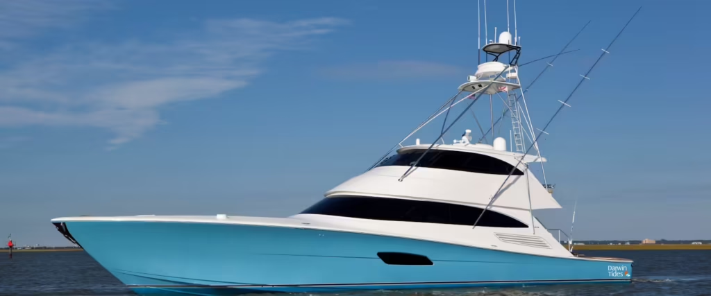
The Darwin region, located at the northernmost tip of Australia, presents unique challenges and opportunities for sailors. The sailing conditions here are heavily influenced by diverse factors such as weather patterns, tides, and ocean currents. Understanding these elements is crucial for yacht owners and fishermen who navigate the waters of the Timor and Arafura Seas, as visibility significantly impacts safety and operational efficiency.
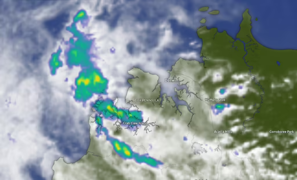
Weather patterns play a pivotal role in determining sailing visibility. The tropical climate of Darwin brings wet and dry seasons, each with distinctive weather phenomena. During the wet season, typically from November to April, heavy rains and passing storms can reduce visibility dramatically. Conversely, the dry season from May to October generally offers clearer skies and better visibility, although sailors must remain vigilant to sudden squalls that can occur unpredictably. Moreover, the prevalence of morning fog can pose additional challenges for navigation.
🌊 Tides and Currents
🛳 Ports
Local ports and coastal towns in the Northern Territory, such as Darwin, enhance the overall sailing environment by providing vital services and information to mariners. These hubs offer amenities like fuel, food, and shelter during adverse weather conditions, allowing sailors to make informed judgments based on the latest sailing visibility updates. By understanding the factors affecting sailing visibility in this region, sailors can better prepare for their journeys, enhancing both their safety and enjoyment while navigating the beautiful waters of the Darwin region.
Tides and currents are also critical factors worth considering. The Darwin region experiences significant tidal variations, which can affect water depth and currents. Sailors must be knowledgeable about local tide schedules, as improper timing can lead to grounded vessels or hazardous conditions around shallow areas. Currents in the Timor and Arafura Seas can change swiftly, impacting the ability to maneuver and navigate, especially in narrow channels and entrance points to local ports. Familiarity with these dynamics is essential for ensuring safe passages.
Navigational Visibility Tools for Safe Sailing
📡 Global Positioning System (GPS)
📻 VHF Radio
Sailing in the Darwin Region’s pristine waters demands an array of navigational tools to ensure safety and enhance visibility. The integration of advanced technologies like GPS devices profoundly revolutionises nautical navigation by providing precise location data, which is vital for avoiding hazards and optimising sailing routes. Marine GPS units offer real-time updates, allowing sailors to pinpoint their position with great accuracy. This is particularly important in the coastal areas of the Northern Territory where intricate waterways and changes in landscape can obscure traditional navigational references.
Complementing GPS devices, VHF radios serve as an essential communication tool in maritime activities. These radios enable sailors to communicate with other vessels and coastal authorities, ensuring quick access to crucial information regarding weather updates and navigational warnings. The presence of a reliable VHF radio can significantly mitigate risks during unexpected situations by fostering immediate support from nearby boats or emergency services.
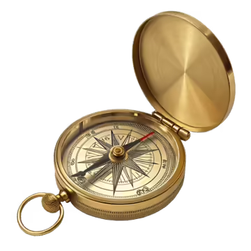
Old World Tech
A compass, while often underestimated in an age dominated by digital navigation, remains an indispensable tool for any sailor. It offers direction and aids in chart navigation. Sailors familiar with compass readings develop better situational awareness which is key when navigating through the Northern Territory’s shifting and sometimes unpredictable coastal waters.
Furthermore, marine charts are critical for visual navigation, providing information on water depths, hazards, and specific sailing routes. An updated chart in conjunction with the aforementioned navigational tools enhances the overall safety of maritime activities. It is also worth mentioning that visibility in these waters can fluctuate with sea temperature variations. Warmer temperatures may cause visibility issues, affecting not only sailing conditions but also fishing practices. Thus, understanding the interplay of environmental factors and utilising the right navigational tools is crucial for enhancing safety while navigating the Darwin Region’s diverse marine landscapes.
Safety Equipment and Best Practices for Sailors
Ensuring safety on the water is paramount for all sailors, especially in the dynamic and often unpredictable conditions found in the Darwin region. A well-prepared sailor should have essential safety equipment onboard to promote not only personal safety but also that of fellow crew members. This includes emergency beacons, which can be pivotal in alerting search and rescue teams in case of an emergency. These devices can transmit a distress signal over satellite networks, ensuring timely assistance in critical situations.
🛟 Flotation Devices
⚠️ Man Overboard Rescue
☔ Weather Conditions
Flotation devices are another essential component of safety gear. Life jackets should be worn at all times, and it is advisable to have additional flotation devices readily accessible for passengers. These products come in various sizes and types, catering to different activities and body weights, and selecting the right one can significantly enhance safety during sailing trips.
Man overboard (MOB) rescue systems are also crucial for ensuring safety at sea. These high-visibility devices and systems help facilitate swift recovery of individuals who accidentally fall overboard. Familiarising oneself with the use of these systems and conducting regular drills with the crew can prepare everyone for quick action should an incident arise.
Beyond equipment, optimising safety involves adopting best practices while on the water. Sailors should stay informed about weather conditions, including potential storms or high winds, which can significantly impact sailing endeavours. Utilising reliable weather forecasting services can help in planning safe excursions. Moreover, understanding the currents in the Darwin region can greatly assist sailors in navigating the waters more effectively, minimising risks associated with unexpected tidal changes. Regularly reviewing and discussing safety protocols with crew members may also foster a culture of safety onboard, creating a more enjoyable and secure sailing experience for all. By prioritising both safety equipment and best practices, sailors can confidently explore the stunning waters of the Northern Territory.
Latest Forecasts


🛫 Cheap Flights to Darwin
Limited Time Deals


When you buy through the darwintides.com website, you can take full advantage of eBay’s great benefits and features, including WorldWide Free Shipping on many items and a 30 Day Money Back Guarantee (Ts & Cs apply).
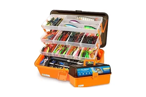
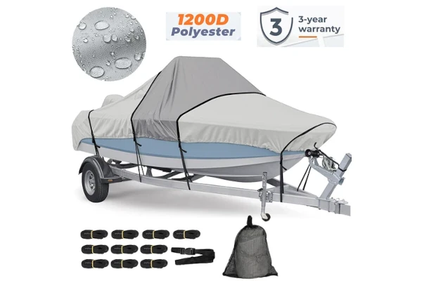
Visit the Darwin Tides Shop for More Fishing, Boating and Marine Supplies!